BathyNav is an open-source bathymetric mapping simulation framework built on HoloOcean, developed as part of my master’s thesis, Hybrid Monte Carlo Tree Search and Cross-Entropy Planning for Adaptive Bathymetric Planning.
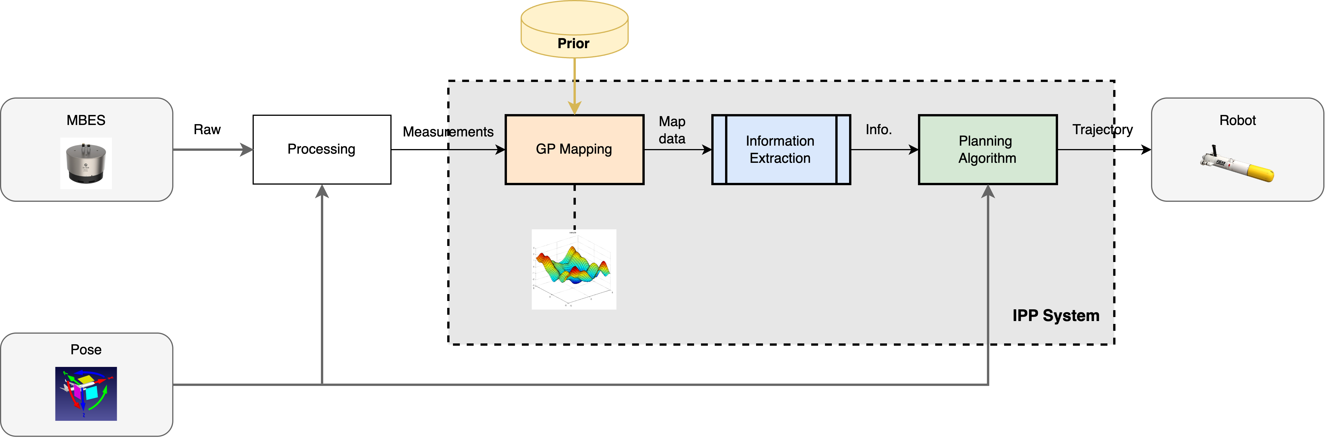
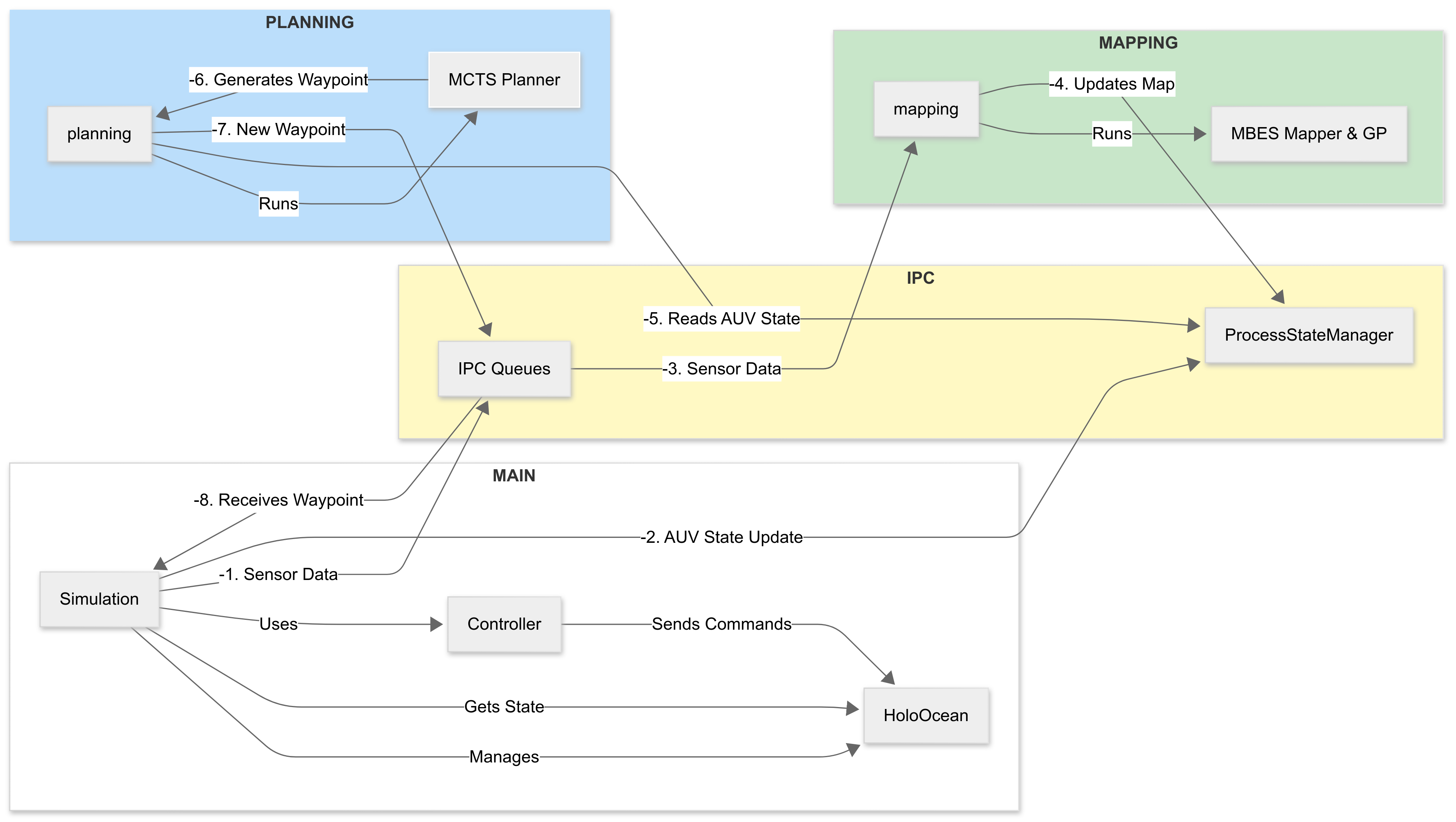
The framework lets you simulate an AUV exploring unknown seafloor terrain: multibeam sonar readings are fused into Gaussian Process maps, and a hybrid planner decides where to go next to map efficiently. Mapping, planning, and simulation run as separate processes coordinated over IPC queues as shown above.
You can find the full thesis here.
Resources
- HoloOcean documentation — underwater simulation environment this project builds on
- Monte Carlo Tree Search: A Tutorial — readable overview of the planning algorithm at the core of the thesis
- The Cross-Entropy Method for Motion Planning — intro to CEM, the other half of the hybrid planner
- Efficient Non-Myopic Layered BO for Bathymetric IPP — recent work on GP-based bathymetric mapping with AUVs
- Gaussian Processes for Machine Learning — the textbook reference if GP mapping is new to you